Erez Speiser – Israel Scenic Roads (Part 1)
In this series of posts, we will introduce some of Israel’s most scenic roads. All of them offer both great views and interesting attractions along the way.
Road #98 – Golan Heights
Start point: Near the Sea of Galilee. GPS (32.702040, 35.602403)
End point: Hermon Ski resort GPS (33.307029, 35.771786)
Region: Golan Heights
Length: 99 Km
Driving time: 01:50 Hours.
Best season: Winter and spring.
Road #98 crosses the Golan heights from South to North on its eastern side along the Syrian border. The area is the least inhabited in Israel’s north part and therefore provides a feeling of vast space.
It starts at the South tip of the sea of galilee at elevation of -200 ASL, climbs steeply to the southern Golan that is about 400 m ASL, and ends at the base of the Hermon Ski resort at 1500 m ASL.
Main Attractions:
Section 1 – From lake Kinneret to Afik Junction.
- Great views on the canyon of the Yarmouk River (A tributary of the Jordan river) that form the border between Israel and Jordan in this area.
- Hamat Gader Hot springs resort.
- Steep climb with many serpentines…………
- Amazing Views on the sea of Galilee from the Mevo Hama Promenade
More Detailed descriptions and optional short hikes in this section
Section 2 – From Afik Junction to Kibbutz El-Rom.
- Optional hike to the Bashanit Ridge
- Visit the Golan Volcanic Park
- Visit the interesting Oz 77 Memorial and learn some interesting history from the Yom-Kipur War.
- Fantastic Views on Mount Hermon (2800 ASL and snowcapped during the winter)
Section 3 – From El-Rom to Mount Hermon.
- Visit the Druze villages of (Bukaata, Masaade & Magdal Shams)
- Visit the Ram pool
- Drive up to Mount Hermon Lower Ski lift station
- Take the Chairlift to enjoy great views on the Galilee & Hula valley.
Road #667 – Gilboa
Start point: Jezreel Valley GPS (32.554360, 35.333360)
End point: Jordan Valley GPS (32.432091, 35.485953)
Region: Jezreel Valley
Length: 27 Km
Driving time: 45 Minutes.
Best season: Winter and spring.
Drive from Jezreel Valley to the Jodan Valley on top of the Gilboa ridge with amazing view and interesting Biblical stories.
King Saul and his sons Jonathan, Abinadab and Malchishua all fell on Mount Gilboa in a battle between Israel and the Philistines. The sons were slain; Saul was critically wounded and begged his armor-bearer to run him through with his sword. Terrified, the soldier refused, so Saul “took his own sword and fell on it” (I Samuel, 31:1-4). When he heard the news, David wept bitterly. Heartbroken at the loss of his king – and his best friend – he cursed the mountains of Gilboa in the Lament of the Bow: “O mountains of Gilboa, may you have neither dew nor rain, nor fields that yield offerings of grain.” [II Samuel, 1:21]. If you visit the Gilboa in spring, the mountain’s masses of wildflowers seem to belie the curse. Come in summer, however, and you can’t help but feel its effect. Read More…..
Main attractions:
- Mount Shaul lookout and Paragliding takeoff point.
- One of the most attractive areas in Israel to experience Wildflowers.
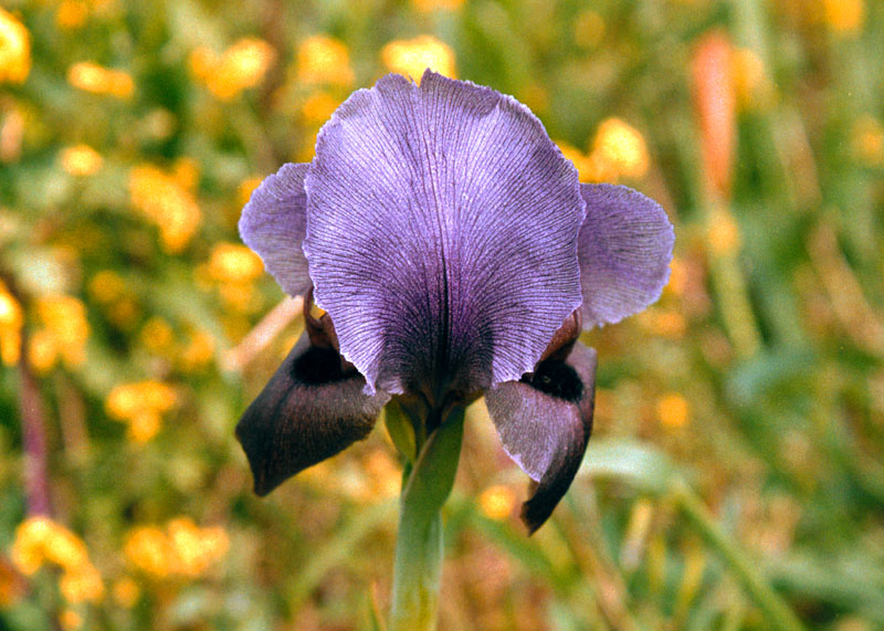
- Mount Barkan lookout. (The best spot to see the famous Gilboa Iris if you are lucky enough to arrive in the right time).
- Avinadav Lookout. Great views on the Jordan valley.
- Non-stop views on the Jordan valley and the Gilad mountains across the border in Jordan as you descend the eastern slopes of the ridge.


